


What is Kobotoolbox?
Check out this short video explainer. Kobotoolbox is a tool developed by a nonprofit aimed at making tools that permit rapid data collection in crisis situations. A data collection form created with Kobotool box works offline and only uploads the data you’ve collected once your device is in wifi or cell coverage. I have already created a form for you that uses the DEBS mortuary archaeology data scheme; you can access it here: https://ee.kobotoolbox.org/x/uIGvnNmd. Load that form before you go into the field, and leave the tab open on your device. If a recording form requires or can collect geolocation data, it will ask for permission from you to use your device’s geolocation.
Recording Gravestones with Kobotoolbox
You will need a smartphone or table while on site.
If you don’t have a device that you can take into the field, you can print out multiple copies of the data entry form behind this link and then enter the data using the forms below on a desktop computer later (or use the computer-vision workflow to transcribe it from an image).
Before you go out to the graveyard The digital forms can be used for off-line data recording. Open the link on a smartphone or tablet when you are connected to wifi or data. On the top right of most mobile browsers, there’s a button you can click for options; one of these will be ‘add to home screen’
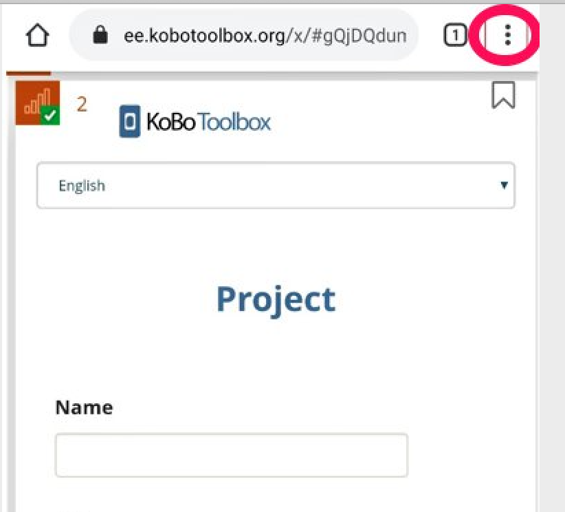
The forms are smart enough to only upload the data when you have a wifi connection, so you can use the forms to record data even if mobile data is expensive or unavailable.
Step 1. Devise a short id code for the graveyard. Archaeological sites in Canada are enumerated using a ‘Borden number’ based roughly on the latitude and longitude of the site. We won’t use a Borden number (it’s entirely possible of course that a graveyard might actually have a Borden number if it was ever excavated or added to an inventory). For our purposes, let’s assume this graveyard is an archaeological site under the Borden scheme - devise a 4 letter code that abbreviates a common name for the graveyard.
Step 2. We’ll use this scheme - http://debs.ac.uk/files/CodeSheets.pdf - to codify our observations for entry into our recording system. I would suggest that you print it out, staple it together, and bring it with you.
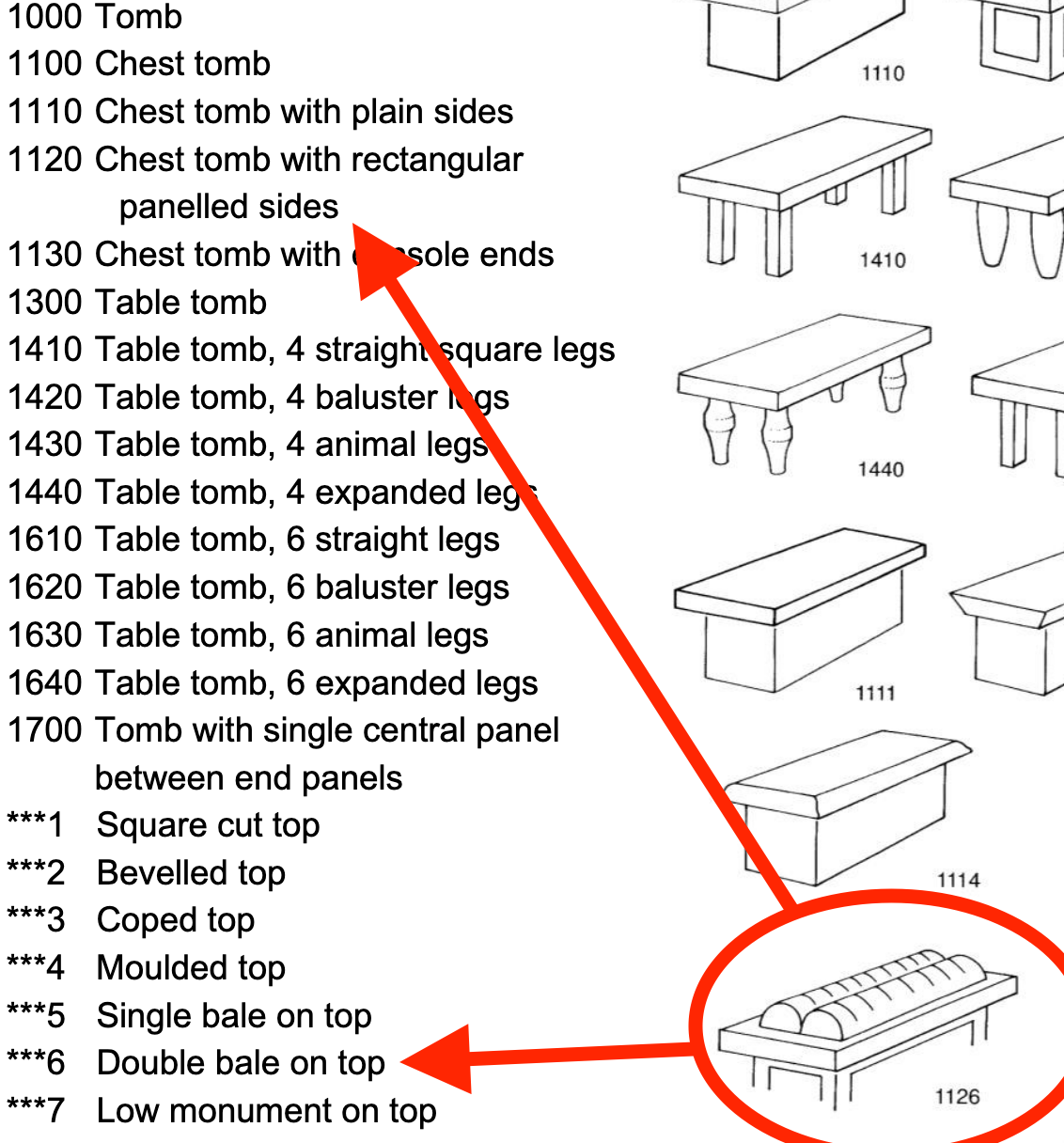
The numbering system builds up to describe a stone, monument, or tomb. For instance, in the illustration below, 1126, each digit is significant. The first 1 indicates chest and table tombs, the next two digits differentiate between chest tomb with plain sides (11) and chest tomb with rectangular panelled sides, 12, and then the final digit describes the decoration on the top, 6, what is called a double bale. Headstones begin with 4 and the combination of digits can be used to describe quite complex shapes and motifs.
Step 3. Then, record the stone & the inscription with this: https://ee.kobotoolbox.org/x/uIGvnNmd. It works best with Chrome. Deciding precisely which numbers best describe what you are observing will be a challenge. As you work, make a note of problems you encounter with the scheme - what assumptions are literally encoded that do not seem to reflect what you are seeing? Are there shapes that just don’t seem to fit?
Step 4. You fill in as many of the fields as possible, but make sure to always add the ID for the graveyard and for the stone in question. The location field will try to automatically get your location from your device; the plus-minus on this can be quite variable. Do take a photograph (there is a field that will do that). When you press the submit button at the bottom of the form, the results will be queued and saved locally in your device, and then you can record the next stone. Once you turn data on or are back in wifi range, your results will upload automatically to the server.
Step 5. You can record the personal information on the stones with this form, which works in the exact same way: https://ee.kobotoolbox.org/x/vFoK4DMY